CU Denver and MIT researchers capture real-time data on the Kīlauea volcano’s eruptions
A group of researchers set out to study extreme air quality events on the Island of Hawai’i and elevated their data collection with QuantAQ's MODULAIR units.

Countless everyday experiences, from a fire truck driving by to chili cooking on a gas stove, can increase air pollution, which poses a threat to public health and safety at high levels. At the same time, an important fraction of humans’ exposure to air pollutants can be attributed to extreme air quality (AQ) events, such as wildfires or volcanic activity. Because of their dynamic nature, combined with inadequate monitoring infrastructure, extreme episodes can be incredibly difficult to track. However, understanding them is crucial to improving emergency response capabilities and protecting public health. With this in mind, a group of researchers, including QuantAQ co-founder David H. Hagan, set out to study them on the Island of Hawai’i.
An eruption from the Kīlauea volcano in 2018 drew researchers from MIT’s Department of Civil and Environmental Engineering and the CU Denver Department of Geography and Environmental Sciences to monitor the resulting volcanic plume’s effects on the island’s AQ. The group built and deployed a custom low-cost sensor (LCS) network of 30 nodes to study the mixture of volcanic sulfur dioxide (SO2) and particulate matter (PM), known as “volcanic smog,” or “vog,” that loomed over the island.
In their 2021 paper, published in PNAS (Proceedings of the National Academy of Sciences), the researchers establish the utility of LCS networks, in combination with government-regulated monitoring systems, for emergency response in extreme AQ events. Ground-based regulatory sensor networks in the United States are generally operated by a state’s Department of Environmental Protection, monitoring AQ data to comply with the Clean Air Act. The networks provide highly accurate data but are extremely expensive. As a result, they are sparsely located and can offer incomplete information on how much air pollution inhabitants are exposed to from neighborhood to neighborhood, or minute to minute, in a constantly shifting situation following an extreme air pollution episode.
With the complementary LCS networks in place, the group was able to gather more detailed, localized data to estimate the population’s exposure to pollutants from the vog.
“We can really get a fine-grained understanding of what people are breathing in different places [with LCS networks] compared to normal regulatory networks on the stations,” says Ben Crawford, lead author of the study and assistant professor in the Department of Geography and Environmental Sciences at the University of Colorado at Denver.
Powering a new wave of research with the MODULAIR

After capturing a brief snapshot of SO2 and PM levels during the Kīlauea Lower East Rift Zone eruption for the initial paper, the project has expanded to consistently monitor how the volcanic plume is evolving and affecting the local population. Hagan’s participation in the research and demonstrated atmospheric science expertise highlighted the suitability of QuantAQ’s MODULAIR units for Crawford in moving the project forward.
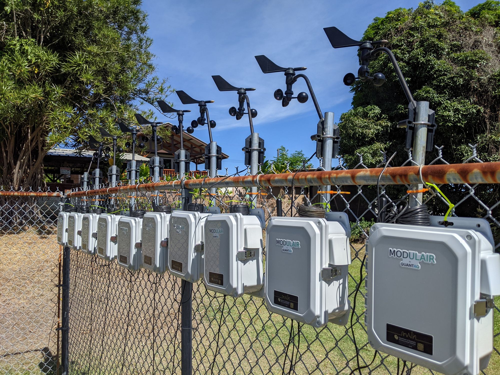
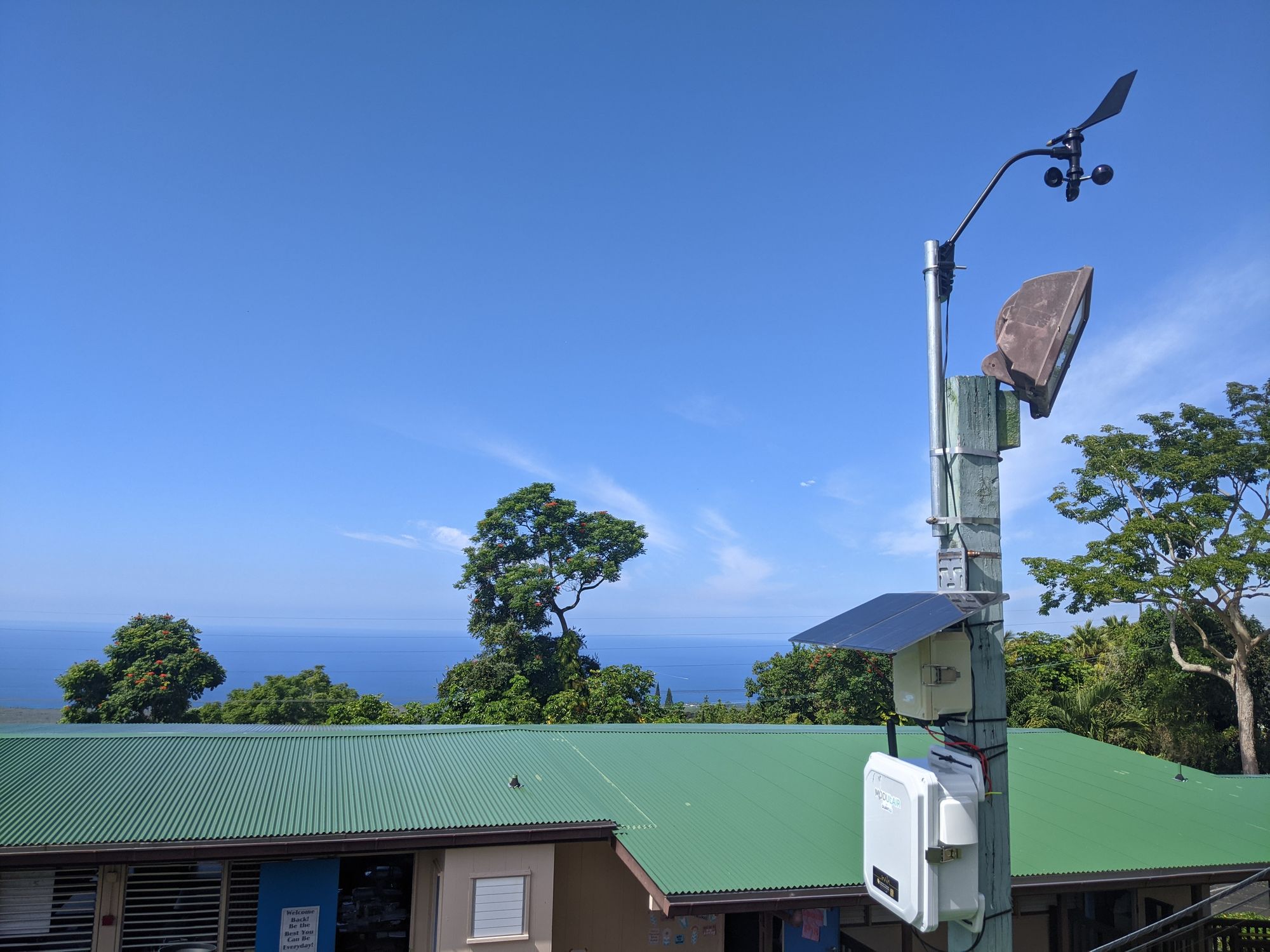
Replacing the original network of LCS with 16 of QuantAQ’s newest models provided Crawford and his team with more robust data and streamlined pathways to continue their research. Using the MODULAIR’s novel combination of OPC and nephelometer sensors, “we can use more advanced techniques to measure particle size distributions,” Crawford says.
With each sensor sending real-time data to the QuantAQ Cloud, researchers like Crawford can focus their efforts on the science, rather than logistics, of collecting their data.
“The web interface makes it really easy to see what sensors are doing in real-time and keep tabs on the network. I'm an atmospheric scientist. I'm not a web developer, so having that interface ready to go is really great,” he says.
The project also welcomes the local population to engage with its AQ health. As many of the sensors are hosted at schools and public health clinics, the project has expanded accessibility for students, teachers, and the greater community to get involved and informed on the quality of the air they are breathing.
“I think these kinds of low-cost sensors are a really good way to democratize data,” Crawford says.
Furthermore, gaining insights on pollutant distribution and human exposure from the 2018 Kīlauea eruption opens new doors for research beyond extreme AQ events.
“Having this experience in Hawaii will help us for future field campaigns in more complex environments,” Crawford says.
We’re excited to share more of the incredible AQ work that our customers are conducting to protect our populations from air pollution! Stay tuned.

